John Draper Website Update: WaveWatch, Ham Radio, and AI Development
The past several weeks have been extremely busy for me as development continues on my new project called WaveWatch. I am not quite ready to reveal all the details publicly yet, but I can say that the project has been moving forward rapidly, especially with the help of modern artificial intelligence development tools.
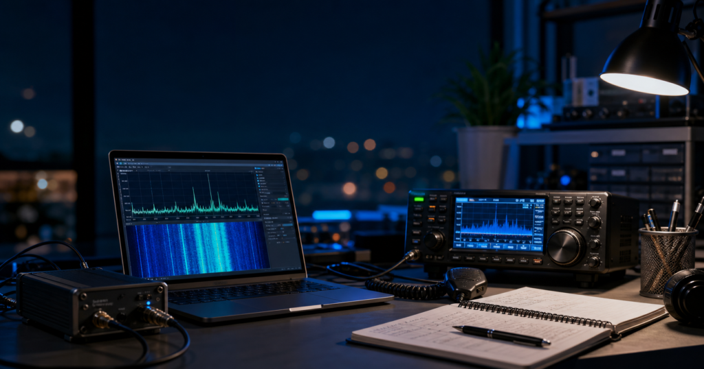
Recently, I attended meetings with the Henderson Amateur Radio Club and had the opportunity to talk with fellow amateur radio operators about the WaveWatch project. The response was very positive, and several members suggested that I create a dedicated Discord server where I can post updates, technical discussions, development progress, and eventually coordinate testing with members of the ham radio community.
That idea makes a lot of sense because projects like this benefit greatly from collaboration between radio operators, SDR experimenters, software developers, and electronics enthusiasts. Amateur radio operators have always been at the forefront of experimentation, innovation, and emergency communications, and I believe AI-assisted software development will become an important part of the future of ham radio technology.
To encourage collaboration and technical participation, I have also posted portions of the WaveWatch source code to GitHub. At the present time, however, access is intended primarily for individuals who are genuinely interested in helping contribute to the project and assist with development, testing, experimentation, and improvement of the system. My goal is to build a collaborative technical community around WaveWatch consisting of radio enthusiasts, SDR experimenters, programmers, and researchers who share an interest in advanced communications technology and AI-assisted development.
In addition to WaveWatch, I am also involved in two other major technical projects that are currently under non-disclosure agreements, so unfortunately I cannot discuss details publicly at this time. However, I can say that both projects involve advanced technology concepts and have the potential to become extremely significant.
I can also publicly acknowledge that I have been involved in providing technical information in support of the Ukrainian war effort during the ongoing conflict with Russia. The world has changed dramatically in recent years, and communications technology, signal intelligence, and decentralized systems have become increasingly important on the modern battlefield. At the same time, I personally hope the conflict will come to an end soon and that peace can eventually be restored.
One of the most fascinating developments I have witnessed lately has been the explosive advancement of artificial intelligence systems. The software world is changing at an incredible pace. Many programmers are now using AI-assisted coding systems that can dramatically accelerate development and prototyping.
The primary development environment I am currently working with is Cursor, along with AI command-line systems such as OpenAI Codex CLI. For WaveWatch development, I have also been heavily using Claude AI for programming assistance, debugging, and rapid code generation.
A lot of hardcore programmers are understandably nervous about the rise of AI-assisted development tools because they fear losing their jobs. Personally, I believe the smarter approach is to embrace these systems rather than fight them. AI is becoming a tool that can amplify human creativity and productivity.
The role of the programmer is evolving. Instead of spending countless hours manually typing every line of code, developers are increasingly becoming system architects, prompt engineers, testers, and problem solvers. The ability to clearly describe a problem and guide an AI system toward a working solution is becoming a valuable skill in itself.
Prompt engineering may require a different skill set than traditional hardcore programming, but it opens the door for many more people to participate in software creation and technological innovation. At the same time, experienced engineers and technical thinkers still have a major advantage because they understand how systems actually work underneath the surface.
We are entering a completely new technological era, and I am excited to be part of it.
There is still a tremendous amount of work ahead. At the moment, WaveWatch is being developed primarily as a website-based system rather than as a standalone runnable application. Fortunately, that transition should not be too difficult because I have essentially been building it as a web-based platform from the very beginning. Most of the remaining work involves refining the interface, making a few structural changes, deploying it to a public server, and continuing development and testing.
Later on, I plan to expand WaveWatch into multiple platforms, including Android, iPhone/iOS, macOS, and Microsoft Windows applications. That stage of development will come later as the core system becomes more mature and stable.
One thing I still have not fully decided yet is the final domain name for the project. Choosing the right name is important because it should reflect the purpose and spirit of the system while also being memorable and easy to recognize. Perhaps some of you reading this may even want to help suggest ideas as the project continues to evolve.